 |
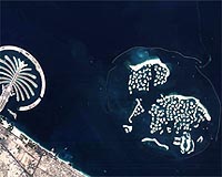
London, UK (SPX) Nov 10, 2008 The scientific community is celebrating 7 years of high resolution hyperspectral satellite imagery from the highly successful CHRIS multi-spectral payload imager. The instrument has been so successful that an advanced variant is under development, offering new functionality for Earth observation missions in a wide range of applications in resource monitoring and mapping, environmental science and security. CHRIS (Compact High Resolution Imaging Spectrometer) was developed by SSTL's Optical Payload Group (formerly Sira Space Group), and placed into orbit in October 2001 on the PROBA mission developed by the European Space Agency (ESA). The sophisticated optical earth imaging instrument recently passed its 7th year in orbit as the highest resolution civil hyperspectral instrument in space. Data from CHRIS has been highly successful in development of new Earth observation applications, and is supporting 94 international Principal Investigators (PIs), acquiring images from over 240 sites in 43 countries for diverse scientific research. Dr. Mike Cutter, SSTL Optical Payloads Group explained the importance and value of such instrumentation, "Hyperspectral instruments have been widely used on aircraft for mineral prospecting and resource management and the CHRIS instruments enable this capability to be used on a national and continental scale, which is critical both for efficient management of natural resources and for providing the information to determine the effects of climate change and mitigation measures." SSTL's subsidiary DMCii schedules and processes images captured by CHRIS for ESA. The data from the mission then used in a wide range of applications including land cover assessment, resource management, deforestation and forest management, precision farming, aerosol monitoring and water quality assessment. The mission also supports International Charter: Space and Major Disasters campaigns by providing high resolution optical imagery of disaster affected areas. The CHRIS hyperspectral images have been in high demand over the past 7 years, and the PROBA / CHRIS mission has pioneered and validated techniques for future scientific and commercial imaging spectrometer missions. Another reason for the scientific demand is that images can be acquired at 5 different view angles for each site, on a single over pass, allowing both spectral and directional signatures to be captured. The new, more advanced CHRIS-2 instrument expands upon this unique capability by including the short wave infra-red band (SWIR), which allows further valuable applications to be addressed including mineralogy, prospecting, crop health and pollution monitoring. Hyperspectral imagers split the available light from a scene into a large range of channels, providing detailed information about the imagery content. Whereas the CHRIS instrument provided up to 62 channels in the visible band, the CHRIS-2 instrument extends this capability to over 200 bands, including the short-wave infra-red bands (SWIR). Placing such an instrument on a spacecraft provides global reach and supports national and international routine imaging campaigns efficiently. SSTL will provide the CHRIS-2 instrument on future Earth observation missions or as a stand-alone payload for integration with third party satellite platforms. Share This Article With Planet Earth
Related Links SSTL Earth Observation News - Suppiliers, Technology and Application
 Greenbelt MD (SPX) Nov 07, 2008
A NASA-led research team has used satellite data to make the most precise measurements to date of changes in the mass of mountain glaciers in the Gulf of Alaska, a region expected to be a significant contributor to global sea level rise over the next 50-100 years. |
|
| The content herein, unless otherwise known to be public domain, are Copyright 1995-2007 - SpaceDaily.AFP and UPI Wire Stories are copyright Agence France-Presse and United Press International. ESA Portal Reports are copyright European Space Agency. All NASA sourced material is public domain. Additional copyrights may apply in whole or part to other bona fide parties. Advertising does not imply endorsement,agreement or approval of any opinions, statements or information provided by SpaceDaily on any Web page published or hosted by SpaceDaily. Privacy Statement |
 del.icio.us
 Digg
Digg Reddit
 YahooMyWeb
 Google