 |
Redlands CA (SPX) Oct 17, 2008 Users of ESRI's RouteMAP IMS software can now access local weather from WeatherBug, the largest weather sensor and camera network in the world, headquartered in Germantown, Maryland. With a network of 8,000 tracking stations, WeatherBug provides up-to-date local weather throughout the United States. The ability to view weather will allow companies to respond to and plan for inclement conditions that may be dangerous or slow down business. This will allow organizations to manage staff and vehicles more effectively, creating a safer and more productive work environment. "Along with other enhancements, like new cartographic elements and enhanced Web page templates, this version of RouteMAP IMS gives customers the flexibility and power they need for routing and mapping in their organizations with very little overhead," says Jay Hoffman, RouteMAP IMS product manager, ESRI. RouteMAP IMS enables users to generate more business activity by allowing prospective customers visiting their Web sites to see maps and get driving directions to business locations. With new features, including the ability to toggle an overview map of a current location, new text placement options that allow street names to follow the street line, out-of-the-box PHP Web page templates, and current weather data streaming, RouteMAP IMS offers all the tools and data an organization needs to create a total Internet mapping and location services solution. RouteMAP IMS continues to include the ability to publish customers' maps to the Web with symbols for unique locations, display and print driving directions and maps to locations, and search for business locations within a 1- to 3,000-mile radius or a customized search area. The unique ability to find what is nearby along a route and see the results in driving directions and on a map is also included. The software contains 24 million integrated D and B business listings for the United States as well as dynamic database connections to Oracle, dBASE, Microsoft SQL Server and Access, and other ODBC-compliant applications. Community Email This Article Comment On This Article Related Links RouteMAP IMS GPS Applications, Technology and Suppliers
 Fort Collins CO (SPX) Oct 16, 2008
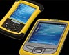
CartoPac Field Solutions has announced the release of its CartoPac Field Server, which allows the deployment and management of mobile field data collection solutions via the web. |
|
| The content herein, unless otherwise known to be public domain, are Copyright Space.TV Corporation. AFP and UPI Wire Stories are copyright Agence France-Presse and United Press International. ESA Portal Reports are copyright European Space Agency. All NASA sourced material is public domain. Additional copyrights may apply in whole or part to other bona fide parties. Advertising does not imply endorsement, agreement or approval of any opinions, statements or information provided by Space.TV Corp on any Web page published or hosted by Space.TV Corp. Privacy Statement |
