 |
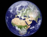
Denver CO (SPX) Jan 22, 2009 Intermap Technologies has announced that its NEXTMap Europe program reached another significant milestone in December by making elevation data for the entire country of France commercially available. For the first time, uniformly accurate 3D digital elevation models and high-resolution orthorectified radar images are available for the largest country (551,695 square kilometers) in the European Union. France joins Germany, Great Britain, and Luxembourg as complete European countries benefitting from Intermap's elevation models and images. Intermap now offers clients more than 1.2 million square kilometers of European data - representing 50% of the NEXTMap Europe initiative that already includes the above mentioned full country datasets and portions of Austria, Belgium, Czech Republic, Denmark, Italy, Spain, Switzerland, and The Netherlands. NEXTMap datasets include digital surface models (1 meter or better vertical accuracy) that depict the earth's surface (including cultural features such as vegetation, buildings, and roads), digital terrain models displaying the bare earth (with all cultural features digitally removed), and orthorectified radar images corrected to remove normal geometric distortions (grayscale and color images that accentuate topographic features). "Intermap is on track to deliver on its commitment to provide users across Europe with a consistent, accurate, and up-to-date geospatial dataset that can help meet the insurance risk assessment, energy development, resource management, and other environmental challenges facing many EU nations," said Brian Bullock, Intermap Technologies' president and chief executive officer. "Moreover, the completion of each new countrywide dataset enables additional cross-border applications and collaboration across the region - a collaboration that was nearly impossible prior to our NEXTMap Europe initiative." Over the coming months, the Company will continue adding entire country datasets to the NEXTMap Europe library until the completion of its NEXTMap Europe program. Data is currently available through the Company's direct sales team, online via www.TerrainOnDemand, or through Intermap's worldwide partner network. Share This Article With Planet Earth
Related Links Intermap Technologies GPS Applications, Technology and Suppliers
 Las Vegas NV (SPX) Jan 22, 2009
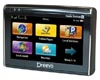
As gas prices fall and more consumers hit the open road again, there is increasing demand for more intuitive, real-time navigation and information support to help consumers get where they're going. In response to this need, Mobile Devices announces the worldwide release of Dreevo 2, a wireless enabled navigation device, and its accompanying ecosystem. |
|
| The content herein, unless otherwise known to be public domain, are Copyright 1995-2007 - SpaceDaily.AFP and UPI Wire Stories are copyright Agence France-Presse and United Press International. ESA Portal Reports are copyright European Space Agency. All NASA sourced material is public domain. Additional copyrights may apply in whole or part to other bona fide parties. Advertising does not imply endorsement,agreement or approval of any opinions, statements or information provided by SpaceDaily on any Web page published or hosted by SpaceDaily. Privacy Statement |
 del.icio.us
 Digg
Digg Reddit
 YahooMyWeb
 Google