 |
Evanston IL (SPX) Nov 22, 2010 What are borders these days? When travel was local, borders and communities were easy to define, but now our connectivity is more complex. It's time to think of borders differently, according to Northwestern University researchers. To reflect today's reality, they have taken a look at human mobility and redrawn the borders within the United States, showing areas of the country that are most connected. Some of the borders in this new map are familiar, but many are not. The research team, led by professor Dirk Brockmann, used the wealth of data generated by Wheres's George? (wheresgeorge.com), a popular website that tracks one dollar bills spent across the country. The many millions of bank notes, having been passed from one person to another, represent links between geographic places. Some divisions were expected, but many were a surprise. Some of the most significant borders split states, such as Illinois, Wisconsin and Pennsylvania. This initially puzzled the researchers, but people who have seen the research and live in those areas say the borders reflect cultural segmentation and the pull of certain large cities. "We also thought that the strong, long-range relationships, such as between Los Angeles and New York, would overshadow the local, short-distance travel, but it did not," said Brockmann, associate professor of engineering sciences and applied mathematics at the McCormick School of Engineering and Applied Science. "The short distance travel has a stronger impact." Some community divisions fall along more familiar lines, such as purely political boundaries (state lines), political boundaries that reflect geography (the Mississippi River) and others caused entirely by a geographical feature (the Appalachian Mountains cutting through West Virginia). The work already has attracted the attention of diverse individuals and groups wanting to know more about the "mobility neighborhoods." The Federal Reserve System is interested. Commuters to Chicago from northwest Indiana are interested. And a leading American linguist is interested. "The well-defined geographic areas we found show us how people really interact and are connected," said Brockmann, who also studies how infectious disease spreads. "These results open up pathways for investigation in a variety of areas." Where's George allows anyone to record a bill's serial number and then track its journeys as other people spend it across the country. Every time a dollar is spent in a new place, it means someone moved it there. Research has shown that this flux of money data is a good proxy for human mobility. The very large database is truly multiscale: links span thousands of miles, hundreds of miles and just a few miles. "Think of these links as an attractive force connecting two places," said Brockmann, a member of the Northwestern Institute on Complex Systems. "The social and mobility ties represent a gravitational pull of sorts." The information could be valuable to the Federal Reserve for optimizing the transportation of money among the 12 regional Reserve Banks across the United States. A professor of linguistics from the University of Pennsylvania wants to use the travel boundaries in his studies of regional dialect boundaries. The findings support those in northwest Indiana counties who feel more connected to Chicago and favor being in the same time zone. And anyone involved with planning large-scale infrastructure, such as high-speed rail, who needs to know where people want to go, can benefit from the human mobility map, Brockmann said. Using supercomputers, Brockmann and his team applied a random algorithm to the Where's George? data, which collects counties into groups. The traffic within each group is very high - very connected - compared to the traffic between the groups. They ran the algorithm thousands of times, with each run producing a slightly different map. Then they took the results, overlaid all the maps and produced one single map, showing the strongest boundaries. The video, "Follow the Money: Human Mobility and Effective Communities," won first place in the 2009 International Science and Engineering Visualization Challenge, sponsored by the National Science Foundation and the journal Science. A video produced by Christian Thiemann and Daniel Grady, doctoral students and members of Brockmann's research group, illustrates the work. The title of the PLoS ONE paper is "The Structure of Borders in a Small World." In addition to Brockmann, Thiemann and Grady, other authors of the paper are Fabian Theis and Rafael Brune.
Share This Article With Planet Earth
Related Links Where's George Northwestern University Earth Observation News - Suppiliers, Technology and Application
 Climate Change On The Go
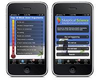
Washington DC (SPX) Nov 22, 2010 GeoOptics has just released a new Climate Mobile app that is free to all. The app allows users to access worldwide climate information, from space satellites and surface instruments (which provide valuable information in their own right and also cross-checks of space data). Users can browse worldwide temperature records from NASA and NOAA (the National Oceanic and Atmospheric Administration ... read more |
|
| The content herein, unless otherwise known to be public domain, are Copyright 1995-2010 - SpaceDaily. AFP and UPI Wire Stories are copyright Agence France-Presse and United Press International. ESA Portal Reports are copyright European Space Agency. All NASA sourced material is public domain. Additional copyrights may apply in whole or part to other bona fide parties. Advertising does not imply endorsement,agreement or approval of any opinions, statements or information provided by SpaceDaily on any Web page published or hosted by SpaceDaily. Privacy Statement |


 del.icio.us
 Digg
Digg Reddit
 YahooMyWeb
 Google