 |
Washington DC (SPX) Aug 16, 2010 Though a plume of smoke still stretched across hundreds of kilometers, conditions in central Russia appeared to be much better on August 12, 2010. The Moderate Resolution Imaging Spectroradiometer (MODIS) on NASA's Terra satellite detected two clusters of intense fires when it acquired a photo-like image. The NASA image is a composite of three separate satellite images. The MODIS Rapid Response Team at NASA's Goddard Space Flight Center in Greenbelt, Md. created the composite image, and diagonal lines mark the seams between each image. The first cluster of fires is southeast of Moscow. Though the fires were producing thick smoke when MODIS captured the image on August 12, the smoke was blowing away from the city. Moscow appeared to have relatively smoke-free skies compared to previous days. The second cluster of fires is in the Ural Mountains. The smoke from these fires extends south into Kazakhstan. Apart from the thick plume of smoke that seems to connect the two fire regions, a lighter pall of smoke hangs over southern Russia and northern Kazakhstan.
Share This Article With Planet Earth
Related Links Terra satellite Earth Observation News - Suppiliers, Technology and Application
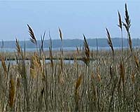 Satellite data yield better wetlands maps
Washington (UPI) Aug 13, 2010 New accurate maps of Chesapeake Bay wetlands will help in studies of areas critical to the health of bodies of water like the Bay, U.S. researchers say. Two U.S. Department of Agriculture scientists used satellite data to created new maps 30 percent more accurate than existing ones, a USDA release said Friday. Because many wetlands are forested, it can be hard to see the wetlands ... read more |
|
| The content herein, unless otherwise known to be public domain, are Copyright 1995-2010 - SpaceDaily. AFP and UPI Wire Stories are copyright Agence France-Presse and United Press International. ESA Portal Reports are copyright European Space Agency. All NASA sourced material is public domain. Additional copyrights may apply in whole or part to other bona fide parties. Advertising does not imply endorsement,agreement or approval of any opinions, statements or information provided by SpaceDaily on any Web page published or hosted by SpaceDaily. Privacy Statement |


 del.icio.us
 Digg
Digg Reddit
 YahooMyWeb
 Google