| . |  |
. |
|
|
. |
by Staff Writers Greenbelt MD (SPX) Sep 12, 2011
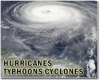
Tropical Storm Maria is making her own "West Side Story" and is headed in the direction of the Lesser Antilles. Satellite imagery shows Maria's close proximity to the island chain in the Caribbean. A visible image from NOAA's GOES-13 satellite showed Tropical Storm Maria approaching the Lesser Antilles in the Caribbean Sea on Sept. 9 at 10:45 a.m. EDT. Maria does not have the signature shape of a mature tropical storm and appeared somewhat amorphous. The image was created by NASA's GOES Project, located at the Goddard Space Flight Center in Greenbelt, Md. One of the songs from there is appropriate for the Caribbean: "Something's Coming": that would be Tropical Storm Maria. Warnings and watches are up through the Caribbean as Maria approaches from the west. Tropical storm watches are in force for: Dominica, Saint Martin, St. Barthelemy, Martinique, Vieques, Culebra, and Puerto Rico. Tropical storm warnings are in effect for Guadeloupe, St. Maarten, Saba and St. Eustatius. Tropical Storm warnings are also in effect for Antigua, Anguilla, Barbuda, Montserrat, Nevis, St. Kitts and British Virgin Islands. At 11 a.m. EDT on Sept. 9, Tropical Storm Maria's maximum sustained winds were near 45 mph. Some slight strengthening is possible in the next day, according to the National Hurricane Center. She was moving to the west-northwest near 17 mph (28 kmh). Maria was about 350 miles southeast of the Leeward Islands near 14.2 North and 57.5 West. Maria's minimum central pressure was 1003 millibars. Maria's tropical storm force winds extend out 175 miles from the center, mostly to the northeast. Maria is expected to pass through the Lesser Antilles tonight on her westward track. The Lesser Antilles are forecast to receive between 3 and 5 inches of rainfall from Maria, with isolated totals as high as 8 inches. The National Hurricane Center notes that "Maria is expected to produce total rain accumulations of 4 to 8 inches with isolated maximum amounts of 10 inches over the central to northern Lesser Antilles, the Virgin Islands, and Puerto Rico. Residents in the Caribbean should remain vigilant this weekend as Maria prepares to bring her own musical version "West Side Story" to the region with heavy rains and gusty winds. Related Links - Bringing Order To A World Of Disasters When the Earth Quakes A world of storm and tempest
|
. |
|
| The content herein, unless otherwise known to be public domain, are Copyright 1995-2011 - Space Media Network. AFP and UPI Wire Stories are copyright Agence France-Presse and United Press International. ESA Portal Reports are copyright European Space Agency. All NASA sourced material is public domain. Additional copyrights may apply in whole or part to other bona fide parties. Advertising does not imply endorsement,agreement or approval of any opinions, statements or information provided by Space Media Network on any Web page published or hosted by Space Media Network. Privacy Statement |

 del.icio.us
 Digg
Digg Reddit
 Google