 |
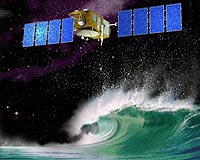
Washington DC (SPX) Dec 18, 2008 NOAA announced that scientists around the world now have access to valuable data from a new international satellite, the Jason-2/Ocean Surface Topography Mission. This information allows them to closely watch the rate of global sea-level rise and monitor changing ocean features around tropical cyclones. Jason-2/OSTM, launched June 20, 2008, is a joint effort between NOAA, the National Aeronautics and Space Administration, France's Centre National d'Etudes Spatiales (CNES) and the European Organisation for the Exploitation of Meteorological Satellites (EUMETSAT). After five months of calibration and validation activities an international team of scientists, including representatives from NOAA, declared the near real-time Jason-2 data were ready for public distribution. A leading NOAA scientist said data from Jason-2/OSTM is especially crucial now. "The sea level is rising at a rate of 3.2 mm/year, nearly twice as fast as the previous 100 years," said Laury Miller, chief of NOAA's Laboratory for Satellite Altimetry. "If this rate continues unchanged during the coming decades, it will have a huge impact on coastal regions, with erosion and flooding. We need the Jason-2 data to help us monitor what's happening." The spacecraft is flying in a low Earth orbit and monitoring 95 percent of the world's ice-free oceans every 10 days. Like earlier missions TOPEX/Poseidon and Jason-1, Jason-2/OSTM is extending the climate data record by providing a long-term survey of Earth's oceans, tracking ocean circulation patterns, and measuring sea-surface heights and the rate of sea-level rise. These are critical factors in understanding climate change. Along with detecting climate change factors, Jason-2/OSTM is being used to assist in forecasting short-term, severe weather events, including tropical cyclones. NOAA will use the altimeter measurements to map the ocean heat content - the fuel that feeds a storm's intensity - along the storm's predicted track. NOAA, working with CNES, is providing ground system support for this mission. This includes: commanding the satellite, downloading all the data and distributing the information to weather and climate forecasters, who are monitoring ocean-born storms and phenomena such as El Nino/La Nina and global sea-level rise. Throughout the mission, CNES will continue to monitor and evaluate the satellite and its instruments. EUMETSAT will process and distribute data received by its own ground station to European users and archive the data. NOAA will process and distribute data received by its ground stations to non-European users and archive the data. NASA will evaluate the performance of the Global Positioning System, laser and radiometry instruments and validate scientific products. "With the successful transition of this important measurement to our partners, NOAA and EUMETSAT, we've entered a new era in the long-term monitoring of sea-level from space," said Lee-Lueng Fu, OSTM/Jason-2 project scientist at NASA's Jet Propulsion Laboratory in Pasadena, Calif. NOAA understands and predicts changes in the Earth's environment, from the depths of the ocean to the surface of the sun, and conserves and manages our coastal and marine resources. Share This Article With Planet Earth
Related Links NOAA Earth Observation News - Suppiliers, Technology and Application
 Canberra, Australia (SPX) Dec 16, 2008
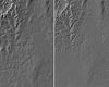
CSIRO is building a three-dimensional computer model of Australia's ground surface topography at scales never seen before. "The new one-second Digital Elevation Model (DEM) provides nearly ten times finer resolution and much greater detail than previous models," says CSIRO researcher and project leader, Dr John Gallant. |
|
| The content herein, unless otherwise known to be public domain, are Copyright 1995-2007 - SpaceDaily.AFP and UPI Wire Stories are copyright Agence France-Presse and United Press International. ESA Portal Reports are copyright European Space Agency. All NASA sourced material is public domain. Additional copyrights may apply in whole or part to other bona fide parties. Advertising does not imply endorsement,agreement or approval of any opinions, statements or information provided by SpaceDaily on any Web page published or hosted by SpaceDaily. Privacy Statement |
 del.icio.us
 Digg
Digg Reddit
 YahooMyWeb
 Google